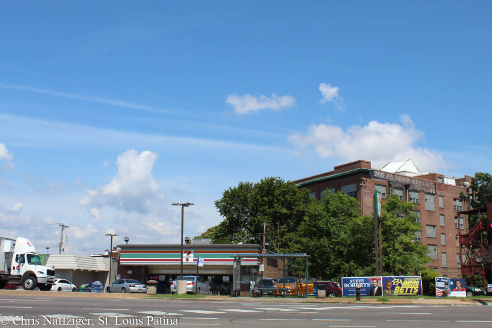
I’ve looked at the intersection of South Jefferson and Gravois avenues in July of 2012, and I came back over the course of several months to photograph the crossing of two of the most important streets in the inner South Side. It’s come a long way from when it was a small exurban village surrounded by sinkholes and wood frame houses.
The southwest corner is now a Lee’s Chicken, and a large swath of asphalt parking.
Views that were once not possible are now possible all the way over to Texas Avenue in Fox Park, past more parking lots.

But back in the early Twentieth Century, we would have seen the above drug store, anchoring the southwest corner with an urban walkable streetscape.

The northeast corner, seen above and in context below with the other corners (note the drug store seen on the southwest corner had been replaced by the 1930s), also possessed a building built right up at the sidewalk.

The bank building is still there, now belonging to a national chain.
But there was actually a building in between the bank and the corner with Sidney at one point, which you can see below, when the bank was under construction or being expanded.

It was probably demolished for the widening of Gravois, or simply for more room for the bank. The building to the right is still there, now housing a hair products store.

The building that was demolished was very old, probably dating to the 1870s if not older.

It has now been replaced with the building below, which may have been an expansion of the bank in the 1980s.
On the northeast corner in between Gravois and Sidney was this stately building, anchored with a giant corner tower.


By the 1970s, looking west on Sidney, the intersection was looking gray and worn out. The historic buildings that would be demolished for the 7-11 were still standing.

Their loss, especially considering their construction back in the 1860s or 70s, is especially tragic since they were replaced with a 7-11 that has proven to be a nexus of crime and other nuisance behavior for years.
But just look below at what used to be there, and this was all demolished in less than fifty years ago.

The spire of St. Francis de Sales Roman Catholic Oratory still stands and dominates the streetscape to the southwest, much as it has for over the last one hundred years.

Below are the Whipple Fire Insurance maps showing the different corners of the intersection. See some of the oldest houses on nearby Indiana Avenue.


Nice work Chris. I always enjoy it when you show the history and the present.
Thanks to you I am still learning things I didn’t know about my hometown.
Fantastic job, Chris! Thank you!
Thank you!
Great write up! How did you come across the whipple plates? I’m looking for an intersection close to Gravios & Jefferson.
http://digital.wustl.edu/w/whi/browse.html
We lived above the Rite-Way Sandwich Shop, Jefferson and Gravois Avenues about 1965. The entrance was on Sidney but, as I recall, the address was 2601 S Jefferson.
Wow, what was it like? That building was approaching 100 years old at that time.
Amazing job as always!