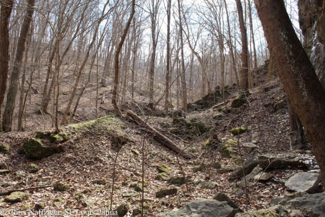
It was a beautiful unseasonably warm day yesterday, so I headed out to Rockwoods Reservation. I had heard some reports of devastating flash floods washing out trails and bridges, so I was not able to access the mines that I had photographed back in 2013. You can just see them through the trees below off in the distance.
But I decided to continue on another trail, looking for other evidence of the quarrying operations that were active here over one hundred years ago. I did some reading, and apparently there was even a narrow gauge railroad. Below, I found this rubble retaining wall. I am not sure what its purpose was, but perhaps it once held a building or some function for the railway.
The rock juts out above the ground throughout this valley. Despite the warm temperatures, the sheltered alcoves kept the waterfalls frozen.
This pile of stone looks suspiciously like it was cast aside rocks from the quarrying operation, left behind for whatever reason from the nearby mines.
Then, I was excited to see the beginnings of a mine tunnel, but one that had been abandoned after just a short probing of the rock face.
Even more exciting, inside are the remnants of quarry railcar chassis, which can be seen straight ahead. If you look at this historic photograph provided in the visitors’ center, you can see the same chassis on the narrow gauge railways going into the open pit mine (which we’ll see tomorrow). Obviously the hopper for holding the rock is missing.
In fact, if you look closer, you can see railroad ties lying under the chassis. I suspect that maybe the rails were actually wood, as well. There is a perpendicular rail lying on top of the railroad ties.
There was a large amount of water dripping down from the rocky outcropping, and there was a thick sheet of ice formed over to the right side of the mine entrance.
In fact, the whole rock face above was moist with water.
I’m not sure what role the steel pipe would have played in the mining operation.
The whole valley was beautiful, and must have been an interesting place to work. Aerial photography from 1937 shows that the forest was largely grown out by then. Whether it had been heavily affected by underground mining is not known to me. Open pit mining to the north heavily scarred the terrain for decades, and the topography is still affected up that way, even with trees and other undergrowth having returned.
Further up the main road in the Reservation there is evidence of rock face mining. Besides mining limestone for building in foundations in St. Louis, some was broken up and burned in kilns to create lime, including in one that is located in further down the valley.


Gosh, I wonder how the July flooding may have affected this area now.
Good question.